

What’s New in the RunGHT Project?
The autumn trek through Eastern Nepal is fast approaching — a key stage in my preparation for the attempt to run the entire Great Himalaya Trail. We’re finalizing logistics: the team will consist of about 10 people, and our guide will be my good friend Rudra, with whom I’ve already had the chance to hike before. On the organizational side, we’re supported by our partner Nepal Climbing Adventure, a trusted agency from Kathmandu.
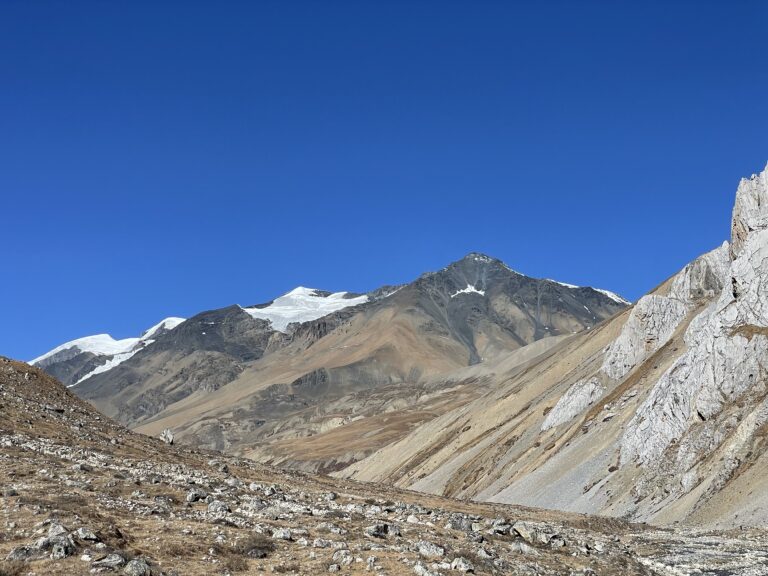
The challenges of the route
Our journey will begin by jeep, taking us deep into the mountains until we reach the village of Ghunsa. That’s where we’ll set foot on the GHT.
From the very start, we’ll face serious challenges. The first real test will be Lumba Samba Pass (5,177 m), reached via a wild, rarely traveled path. Beyond it, another equally remote and uninhabited section leads us toward the Makalu region, where we’ll reach Makalu Base Camp (4,870 m). That will be our last breather before the hardest part of the entire GHT. Because here begins the real trial: the climb to Sherpani Col (6,155 m) — the highest point on the Great Himalaya Trail. From the pass, we’ll have to cross an ice plateau to the next, almost equally high West Col (6,135 m). On the other side lies the Baruntse area — a demanding wilderness of glaciers and raw terrain.
Next comes the technical Amphu Labtsa Pass (5,845 m), often considered one of the toughest in all of the Himalayas. Crossing it will finally bring us into the Khumbu Valley. In the village of Chukhung, we’ll catch a brief rest — here, we’ll find better infrastructure, teahouses, and lodges.
From Chukhung, my running section of the expedition begins. While the rest of the team heads toward Lukla, I’ll take on Cho La Pass (5,420 m), then through the Gokyo Valley and across Renjo La (5,360 m). After a long descent to Thame, I’ll reunite with my guide, and together we’ll move on to the last major obstacle of the trek — Tashi Labtsa Pass (5,753 m). Beyond it stretches the Trakarding Glacier, a demanding crossing requiring roped protection and alpine skills. Only after making it across will I face the final, long descent to Samigaun, where the trek concludes.
Summary
Distance: approx. 400 km
Duration: about 26 days in harsh high-mountain terrain
Elevation gain: ~22,000 m
High passes: 7
This will be an intense experience, requiring not only endurance and resilience but also teamwork and the support of Nepal Climbing Adventure, our partner in Kathmandu. Part of my updates will come via satellite — since much of this region has no communication at all.
Follow my profile if you want to see how this extraordinary and demanding journey unfolds. It’s not only preparation for the great challenge of running the entire GHT — it’s already a limit-pushing adventure in itself: seven passes, weeks in the wild, and the Himalayas at their hardest, yet most beautiful.